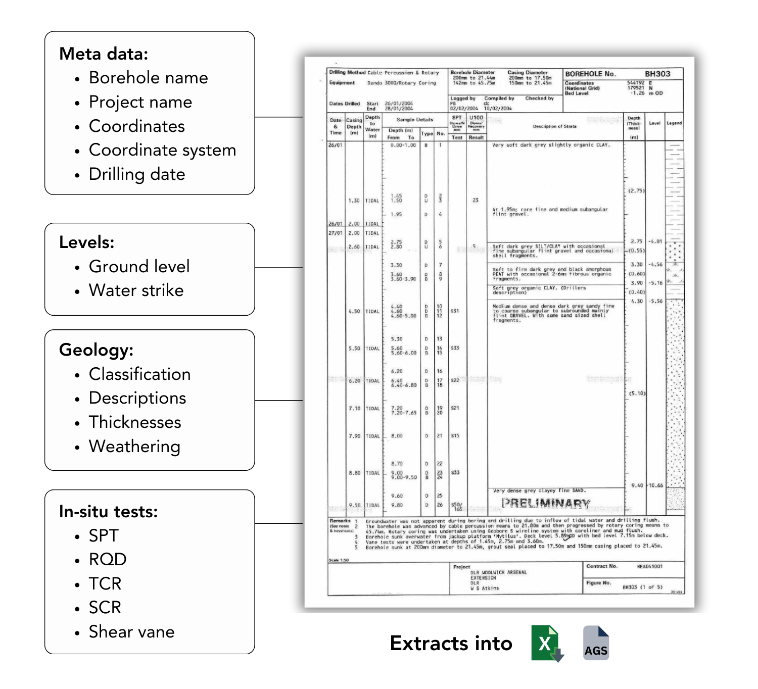
Extract data from PDF borehole logs
AI for Geotechnical & Geological Engineering
How it works

Upload PDFs & Run
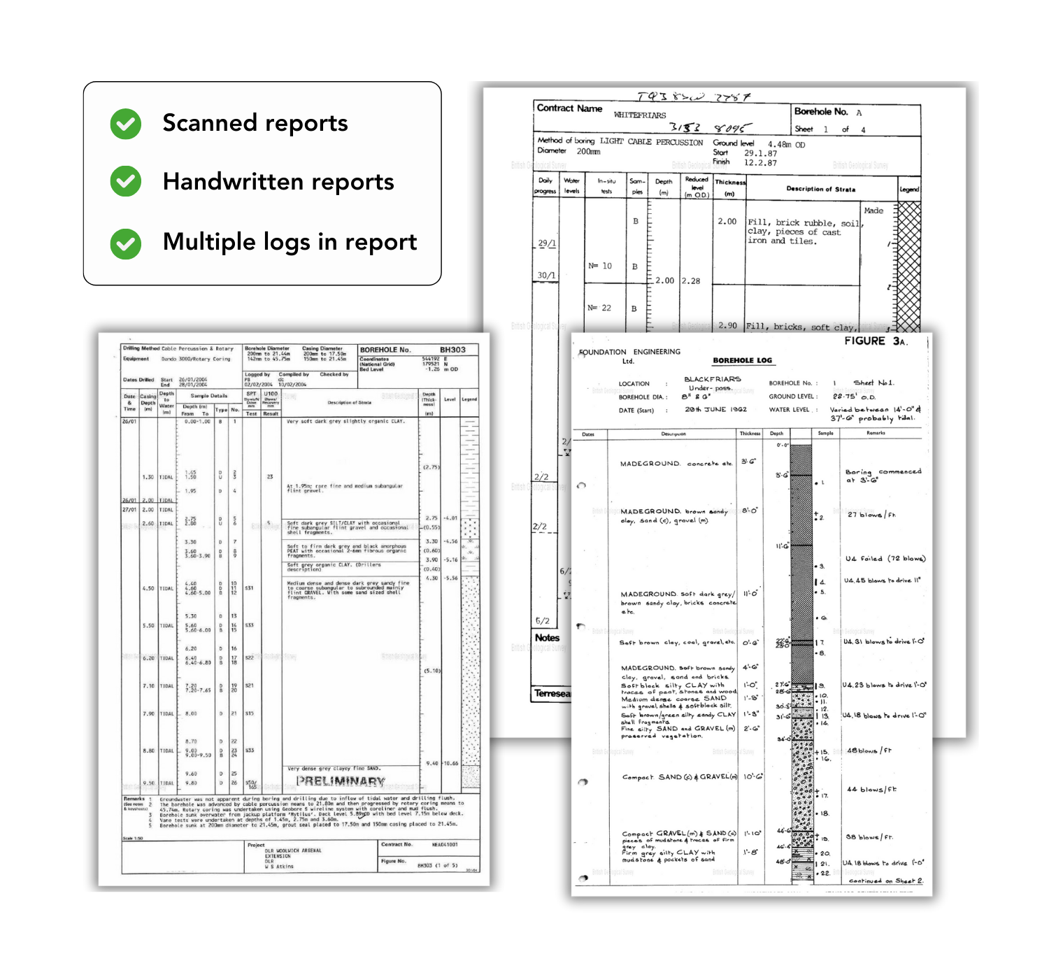
Drag and drop your geotechnical report PDFs into Civils.ai and click Run. Civils.ai automatically begins processing entire reports, including scanned and handwritten logs.

Extract into AGS 4.1 & Excel
The system extracts borehole and lab test data into structured formats — AGS and Excel — ready for QA/QC and integration with your existing workflows.

Geo-located for Mapping
Extracted data is geo-referenced with coordinates so you can map, visualise, and analyse your ground model across sites and projects.
Data extraction accuracy
Extract 16+ different groups of geotech data

Maintains accuracy even for historic scanned reports

Unforseen ground conditions are one of the biggest risks to successfully bidding and delivering infrastructure projects.
Minimise the risk costly surprises with your site by assimilating and analysing your data for risks.
The quality and availability of your geotech data is an edge over your competition.
Invest in the quality of your geotechnical to give you confidence to optimise your designs and deliver more on your projects.
Use AI to gather and structure data from numerous different sources.
Convert entire PDF geotechical reports into geo-referenced digital boreholes plotted on your private map.
Download your data in AGS formats ready for integrating into OpenGround and Leapfrog.
We save your staff's time by eliminating manual transcription of borehole data.
Our solution is 80% cheaper than asking your Engineers and Geologists to manually transcribe boreholes themselves.
Civils.ai pays for itself on your first project (not considering all our other features).
What are our customers are saying?

Edward Armstrong

Geoff Pook

Omid Khalaj

Miro Briss
A workflow run is a single instance of Civils.ai processing your data, some workflows consume more computing power than others.
| Workflow type | Workflow run tokens consumption |
|---|---|
| 1 CAD drawing take-off | 5 |
| 1 Borehole log extracted | 1 |
| Any other workflow | 0.1 |
| AI chatbot querying | 0 (unlimited querying allowed) |
- Upload the full documents (no need to split any documents)
- Select the workflow you want to run
- Our system handles the extraction process (identifying the necessary data to be pulled out from the PDFs)
| Input | How Civils.ai handles the data |
|---|---|
| CAD drawings | Automatically detects and selects only the drawing sheets required for quantity take-off. |
| Data tables (rates, test data, data sheets) | Pinpoints relevant tables and converts them into clean, structured data ready for export. |
| Borehole log PDFs | Identifies each individual borehole log sheet for precise extraction of depths, strata and test results. |
Your uploaded data is stored within a relational database and cloud object storage with our best in class cloud infrastructure provider. All document data is anonymised and un-anonymised data is only viewable the user account from which the data was uploaded.
All data is transmitted through TLS and uses best practice encryption.
You can automatically to delete any data you uploaded at any time by clicking the delete button related to the project or document.
You can also write to us to request that we delete your data at any time and all data related to you will be deleted when you delete your account.
Data is stored securely on servers in the United States, by a vetted, best in class cloud infrastructure provider.
We currently support any form of PDF document or drawings (including handwritten and scanned PDF).
For extraction of data from modern PDF's, we achieve over 95% accuracy including from complex table structures.
For older PDF's (sampled before 1975) these are more challenging and such a high degree of accuracy cannot be guaranteed, but we are sure you will still be pleasantly surprised at how accurate the results are.
We use a human-in-the-loop process on all AI extracted data to ensure output accuracy.
Workflow processing time can vary depending on how complex the data is being extracted and below is a rough indication of processing time.
After you start a workflow running you can close Civils.ai and will be notified once the data extraction is completed via email.
| Category | Processing time |
|---|---|
| CAD drawings | ~ 24 hours. |
| Data tables (rates, test data, data sheets) | 10-15 minutes per document. |
| Borehole log PDFs | 10-15 minutes per borehole. |
We use maximum payment security. If your card is not accepted firstly, disable your VPN or proxy server. Then make sure your name, CVC and postal code match the one on your payment card and of your bank account. Also your card country should be the same as your billing country. And finally make sure you enable 3D Secure or similar authentication on your card with your bank.
We are not currently hiring but always interested to meet new and interesting people for potential future collaborations. We suggest that you join our Discord community and introduce yourself and we can take it from there.
The discord community is also a great place to meet other like-minded digital engineers and share your ideas and we host online events from time to time.


