 Mary Janine L. Kamenić
 Julianna Widlund P.E
 Stevan Lukic CEng
This month's release is focused on making everyday work quicker: a cleaner way to organise the AI agents you use most, a more structured takeoff setup, and a single map view that ties your drawings and ground data together. Here's what's changed and how to use it.
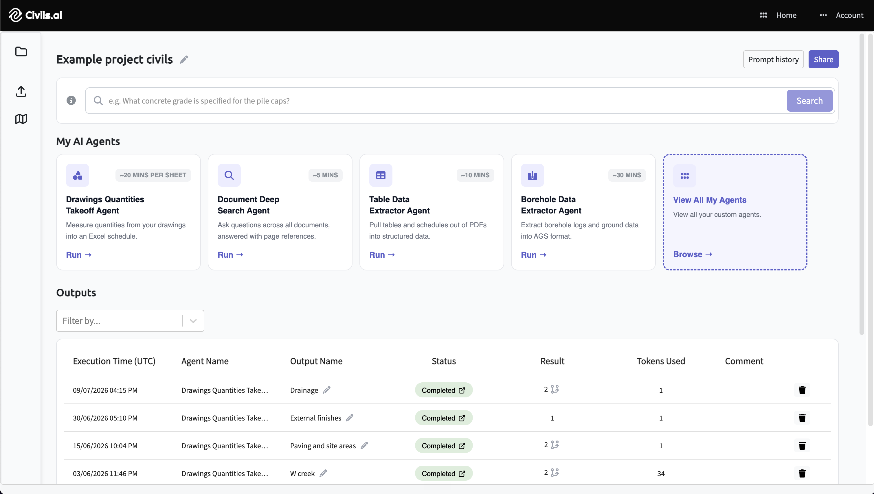
Save and organise your AI agents
We've updated the interface so the agents you rely on are easier to find and reuse, making it easier for those unfamiliar with the features of the software to get maximum value.
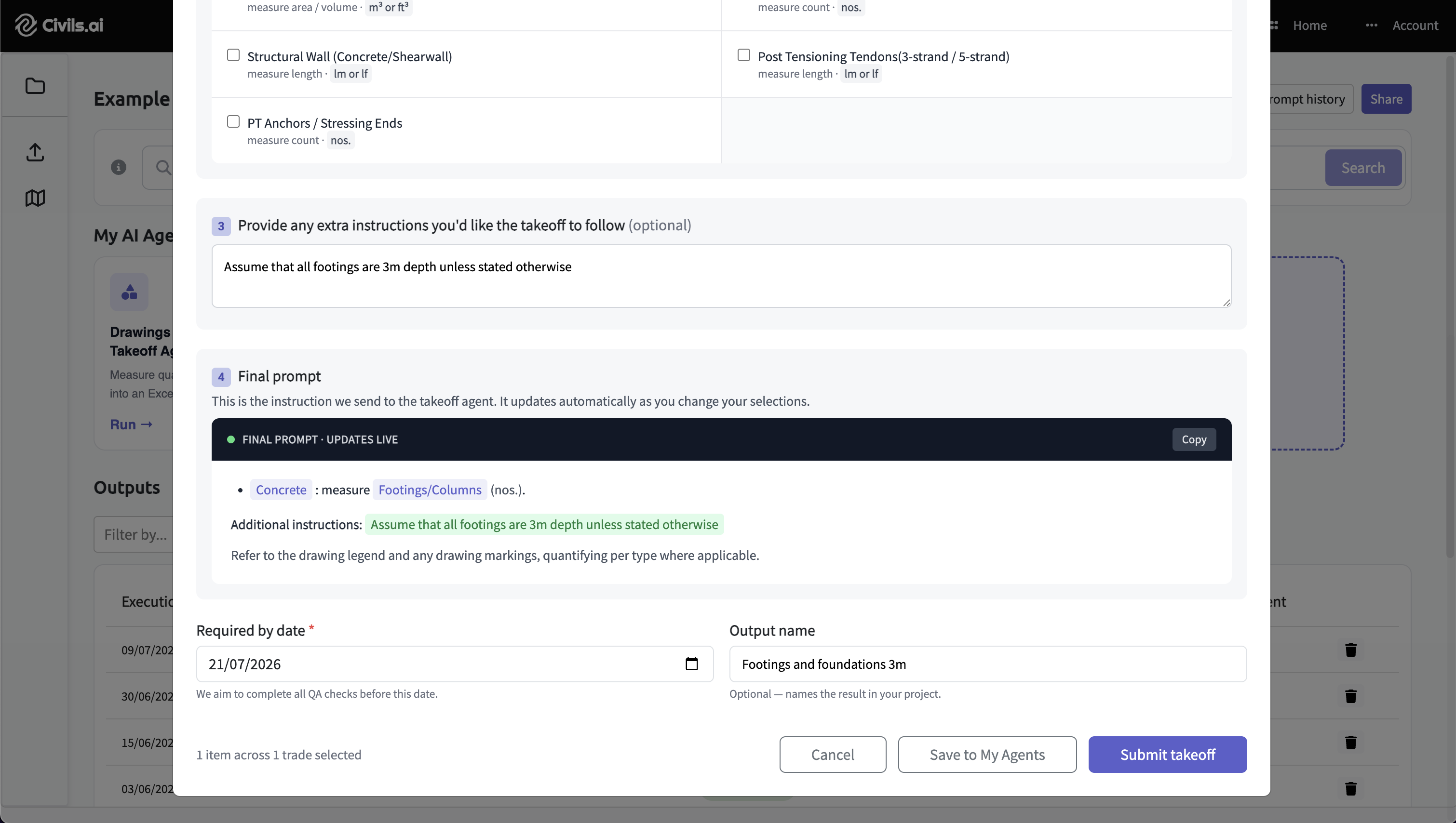
When you set up an AI agent, you can now save the prompt and its configuration by clicking Save to my Agents so that you re-use it again and others in your team find it easier to run something you've already set up.
The saved agent then appears on the View all my agents page.
From that page you can:
Rename an agent so it's clear what each one does
Star your favourites so the ones you use most stay easy to reach
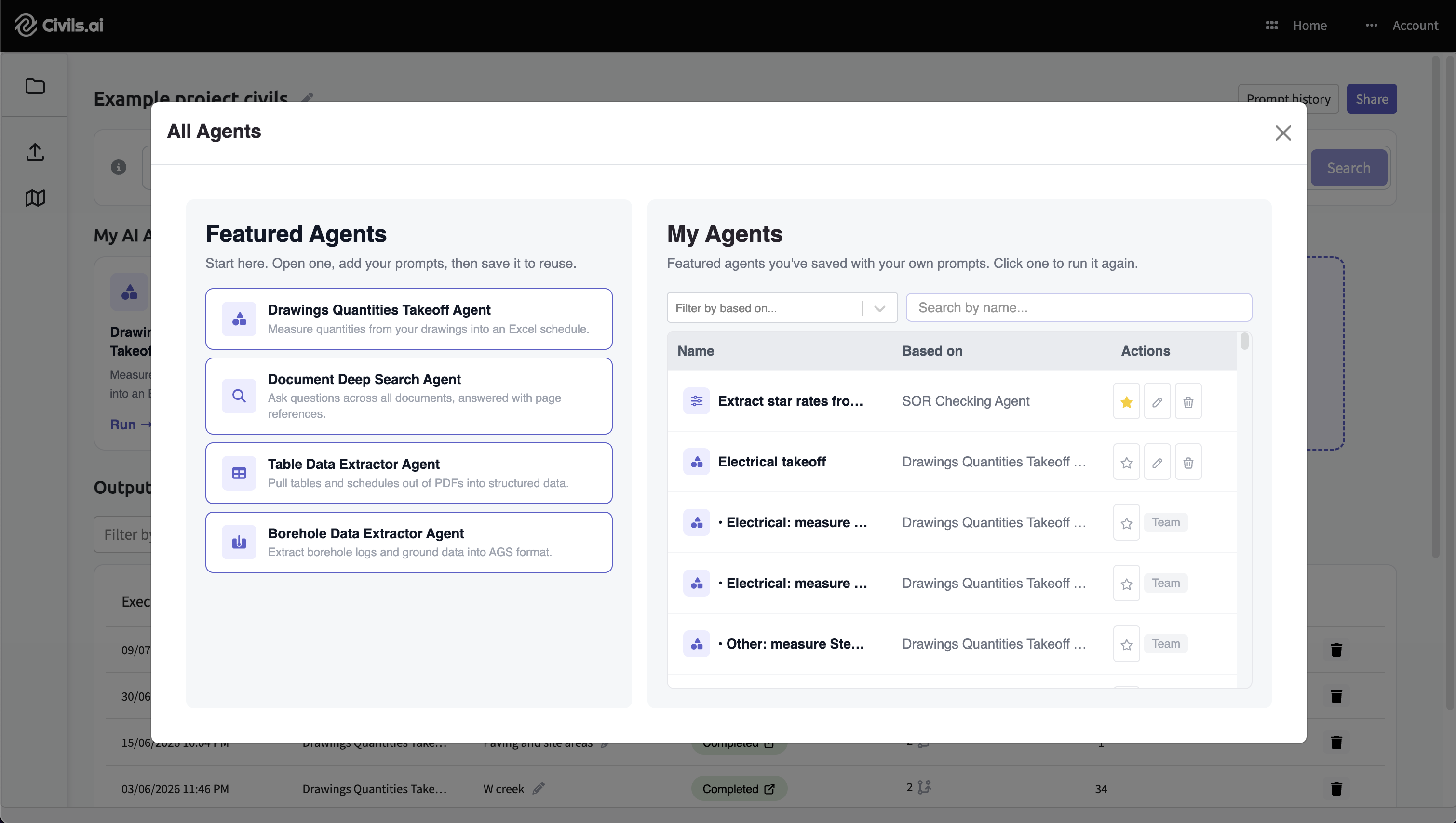
The result is that a takeoff or check you've configured once is ready to run again without rebuilding it from scratch.
Form-based setup for quantity takeoffs
Setting up a quantity takeoff is now form-based, which makes it faster to specify exactly what you need. Instead of describing everything in a single free-text prompt, you work through a short sequence:
Select the general scope of the measurements you need — for example, concrete.
Select the specific quantities to measure within that scope — for example, footings and columns.
Add any extra instructions to refine the measurement or note anything specific to your drawing.
Hit Run, and the AI prepares your draft takeoff.
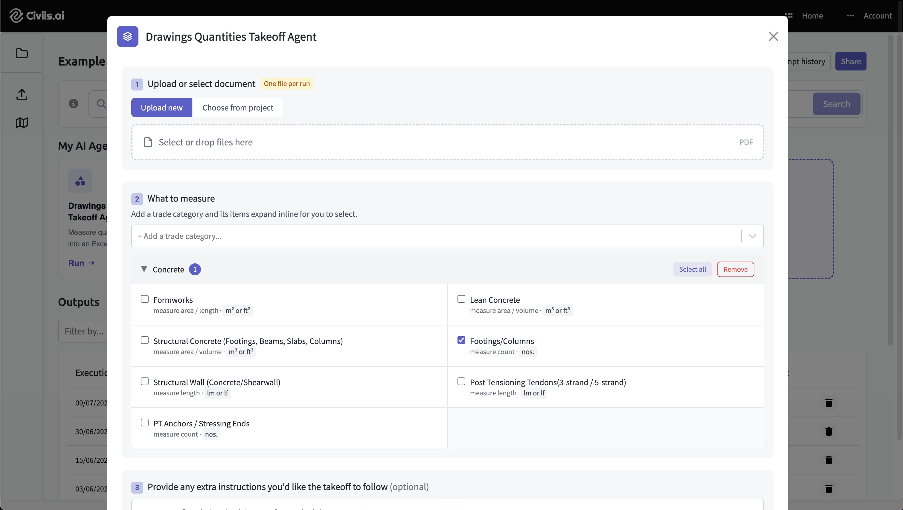
Structuring the setup this way keeps takeoffs consistent and reduces the chance of missing part of a scope. Free-text instructions are still there when you need them — they've simply moved into a dedicated step rather than carrying the whole request.
A unified map view
Following on from July's geo-referencing and Shapefile export, we've brought that spatial work into a single, unified map view. You can now overlay drawings on the map, download the geo-referenced drawing geometry as Shapefiles, and — new this month — visualise it alongside your subsurface and ground data in the same place.
There are two ways to bring data into the map view:
Geo-reference a drawing by clicking Add to map on the takeoff output view.
Add subsurface data by uploading a geotechnical report to the Borehole data extractor agent.
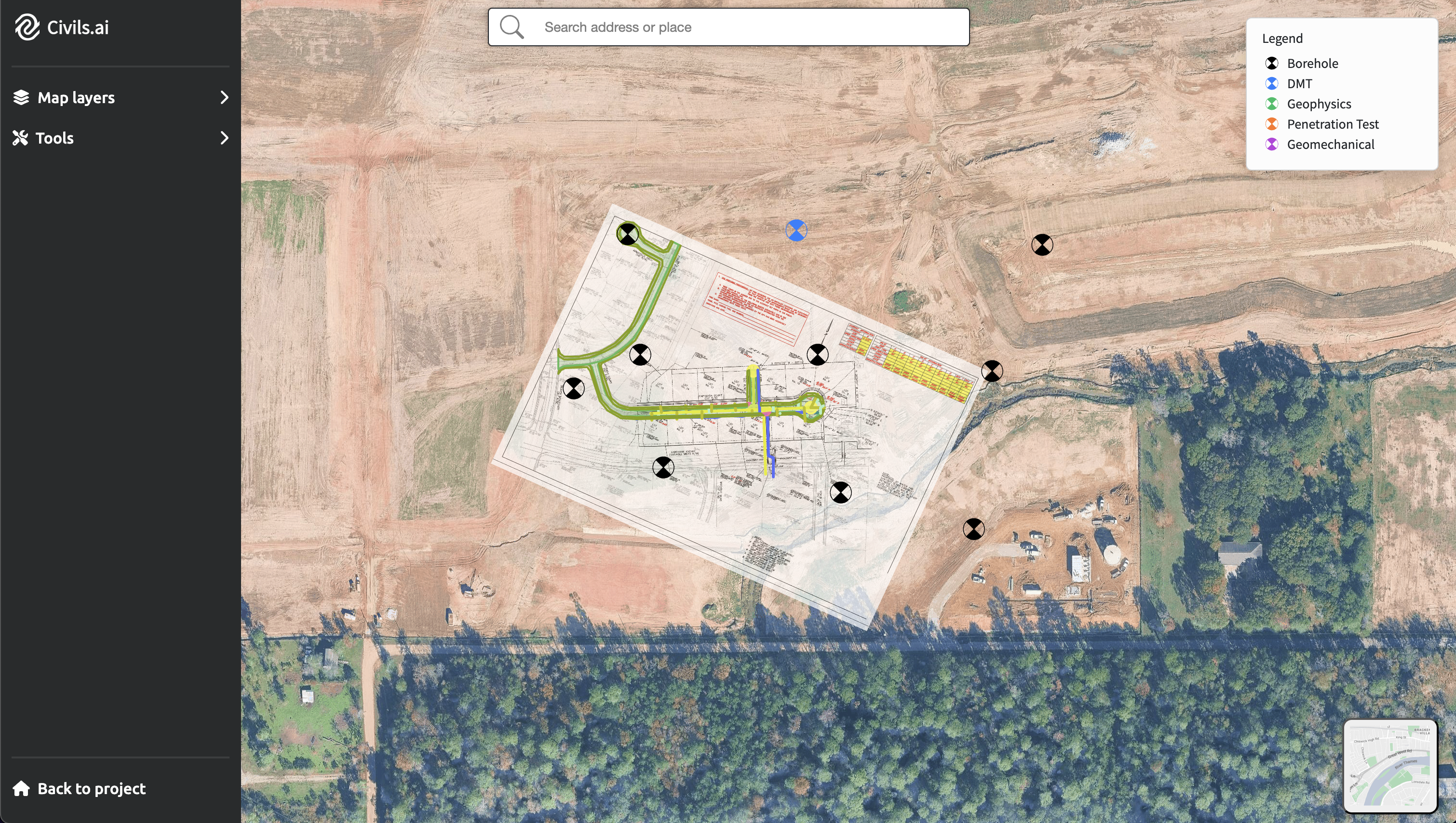
With both on the map together, you can see how a proposed drawing sits against the ground conditions beneath it — useful for foundations, excavations, and utilities work, where the relationship between the drawing and the subsurface is central to the estimate. As before, the geo-referenced geometry can be exported as a Shapefile for use in QGIS, ArcGIS, and Google Earth.
Getting started
All three updates are available now. Saved agents appear on the View all my agents page, the form-based setup is the default for new quantity takeoffs, and the unified map view is accessible once you've geo-referenced a drawing or extracted borehole data.
As always, AI-prepared takeoffs are a draft to support your work and should be reviewed by a qualified professional before issuing. If you'd like a walkthrough of the new map view then don't hesitate to get started below